
March 2024
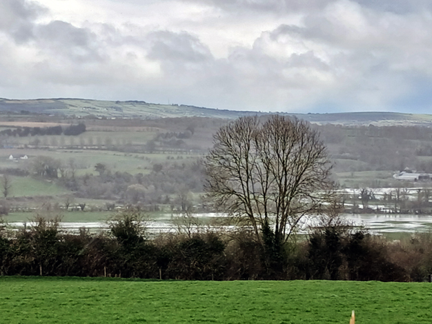
A showery March 27th looking east over the flooded fields near the Bleach Road. The month was much wetter than normal with very few dry days. The mean temperature was about 1° above normal.March Weather Summary:
Another milder than normal month. About 1° above the 1991-2020 mean temperature. Very few frosts. The only day to go below zero was on the 28th when it dipped to -1.1°. Top temperature was 16.1 on the 12th.
Rainfall was very frequent. A total of 111.3mm fell, not quite as wet as 2023. Wettest day was 13th with 18.0mm. Top wind gust was 62 km/hr on the 4th. Snow and sleet was observed for a time on the 1st but it didn't last for long.
February 2024

100s of crocuses in bloom in the middle of February behind the war memorial. Spring came earlier this year with many mild days this month and very few frosts.February Weather Summary:
It was much milder than normal. It ended up the second mildest February on record. Top temp was 14.7° on the 4th and the coldest night was -1.2° on the 1st. There were only 4 air frosts.
It was wetter than normal with a total of 80.4mm of rain. No snow, until the very last day there was a shower of sleet at 4pm.
Top wind gust was 55km/hr on the 4th.
January 2024
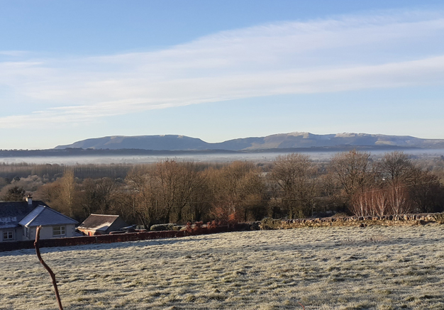
Looking south at the Comeragh Mountains in the frosty clear air near Owning, Co. Kilkenny on January 19th. Frosts were very severe at this point of the month. We had our coldest night for just over 13 years.January Weather Summary:
It was colder and drier than normal. the coldest mean temperature in 3 years. There was however a big range in temperature over the course of the month. Almost 22°. The coldest night was -7.5° on the 19th and four days later it rose to 14.4° during Storm Jocelyn. There were 14 days with air frost and even an ice day on Jan 7th when it failed to rise above zero.
Rainfall was 75% of normal with the wettest day coming on New Year's Day with 11.7mm. There were a few windy episodes with the highest gust of 92 km/hr coming on the evening of the 23rd (Storm Jocelyn).